Posts

Image
FIELD GEOLOGY OF THE SHOALHAVEN DISTRICT   (PART 24) CHAPTER 16 : References and Glossary References   Andrews EC: “Report on the Yalwal Gold Field” (Min.Res.NSW, 9) 1901  Branagan DF and Packham GH: “Field Geology of NSW” (Science Press) 1967  Card GW and Jaquet JB: “The Geology of the Cambewarra Mountain, NSW” (Rec.Geol.Surv.NSW, 8, 261) 1903  Harper LF: “The Geology of the Gerringong District” (Rec.Geol.Surv.NSW, 8(2) 94) 1905  Harper LF: “Geology and Mineral Resources of the Southern Coalfield” (Geol.Surv.NSW Mem 7) 1915  Nashar B: “Geology of the Sydney Basin” (Jacaranda) 1967  Packham GH (Ed): “The Geology of NSW” (J.Geol.Soc.Aust. 16 pt 1) 1969  Paix JG: The Geology of the Shoalhaven Shire” (Shoalhaven Shire Council) 1968  Taylor TG: “Sydneyside Scenery” (Angus and Robertson) 1958  Ulladulla and Wollongong Geological Sheets and Explanatory Notes: (Dep. Mines NSW) 1966     Year 12 Geology Class at Westley Park September 1984 Glossary: Rock and Mineral Names   AGGLOMERATE Coarse,
Image
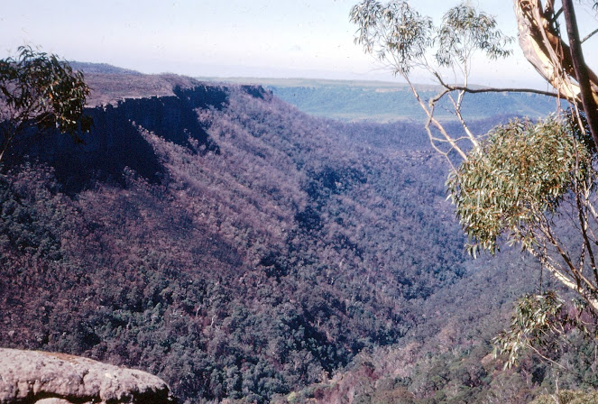
FIELD GEOLOGY OF THE SHOALHAVEN DISTRICT (PART 23) CHAPTER 15: THE CLYDE RIVER VALLEY T aking its rise at an elevation of 2,500 feet near Sassafras, this small river flow south and descends by way of a great canyon to a level of 200 feet at Yadboro. It does this in less than 20 miles, yet it is a further 40 miles to the sea downstream. This is a peculiar result of the dip of the Shoalhaven group sediments. At one time, these must have extended further south than at present. When the area was uplifted, it was tilted to the north, so that the ancestral Clyde River had to erode its bed against this trend.  This undoubtedly led to the formation of many waterfalls and the evolution of the canyon upstream from Yadboro.  The southern edge of the sandstone scarp presents a bold face and is broken into numerous outliers. Some such as The Castle and the Pigeon House are well known to bushwalkers, but there are many others. They all have a similar structure, being capped by cliffs of the Nowra Sa
Image
  FIELD GEOLOGY OF THE SHOALHAVEN DISTRICT (PART 22) CHAPTER 14. The Nerriga District The Permian sediments reach their highest level east of Nerriga and it is in this area that spectacular examples of erosion are most common.  Extensive denudation has exposed the underlying basement rocks over a wide area. These are a continuation of the rocks exposed at Yalwal and Ettrema in the north.  The  Budawang Range  reaches a height of 3,711 feet at Currockbilly Mountain and a similar height at Mount Budawang a little further south. This prominent ridge is the backbone of the basement, consisting essentially of a narrow belt of resistant Devonian strata flanked by Ordovician slates. Marine fossils occur in both these groups as well as sporadic mineralisation. Alluvial gold has been extensively mined, but reefs have rarely proved profitable.  The core of the area described in these pages is a wild confusion of deep valleys and remarkable sandstone peaks. It is a place to be seen only by the bu
Image
  FIELD GEOLOGY OF THE SHOALHAVEN DISTRICT (PART 21) Chapter 13. The Termeil and Durras Districts   Until tourism brought the present growth of holiday resorts, this part of the coast remained relatively unknown. Much of it is still unspoiled and every effort should be made to keep it that way. This is especially true of the coastline between Pebbly Beach and Pretty Beach, where the slopes of the Murramarang Range fall steeply to the sea and tiny islets lie inshore. The whole of the country from Bawley Point south to Bateman’s Bay is thickly covered by spotted gum forest and has been reserved as a State Forest. The only use of the land for farming has been near Termeil, Murramarang and Durras Mountain; the rest is virgin bush.  The Conjola Formation dominates the geology and considerable progress has been made recently towards the unravelling of its stratigraphy. There is a greater thickness of sedimentary rock here than has been measured over most of the area north of Ulladulla and it
Image
  FIELD GEOLOGY OF THE SHOALHAVEN DISTRICT (PART 20) CHAPTER 12.  The Milton-Ulladulla District   The Milton intrusion dominates the geology of this part of the country. Its rich soils lie conveniently close to Ulladulla Harbour and settlers began to arrive here about 1830. However, apart from the country underlain by the Milton Monzonite, the rest of the landscape has changed little since Cook first viewed it in 1770.  Apart from the igneous rocks near Milton, The Conjola Formation is dominant in this area. In recent years there has been a revision in the nomenclature of the Formation and it is now known to consist of sediments of widely varying ages, all within the lower Permian. Contrary to earlier ideas, the lower beds are equivalent to the lower part of the Dalwood Group in the Hunter Valley. Some parts of what has been called the Conjola Formation are as young as the lower Maitland Group. Research into this aspect of Shoalhaven district Geology is still in progress.  Excursion 12