Posts

Showing posts with the label NSW
Image
FIELD GEOLOGY OF THE SHOALHAVEN DISTRICT (PART 23) CHAPTER 15: THE CLYDE RIVER VALLEY T aking its rise at an elevation of 2,500 feet near Sassafras, this small river flow south and descends by way of a great canyon to a level of 200 feet at Yadboro. It does this in less than 20 miles, yet it is a further 40 miles to the sea downstream. This is a peculiar result of the dip of the Shoalhaven group sediments. At one time, these must have extended further south than at present. When the area was uplifted, it was tilted to the north, so that the ancestral Clyde River had to erode its bed against this trend.  This undoubtedly led to the formation of many waterfalls and the evolution of the canyon upstream from Yadboro.  The southern edge of the sandstone scarp presents a bold face and is broken into numerous outliers. Some such as The Castle and the Pigeon House are well known to bushwalkers, but there are many others. They all have a similar structure, being capped by cliffs of the...
Image
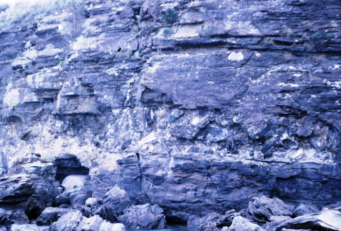
  FIELD GEOLOGY OF THE SHOALHAVEN DISTRICT (PART 21) Chapter 13. The Termeil and Durras Districts   Until tourism brought the present growth of holiday resorts, this part of the coast remained relatively unknown. Much of it is still unspoiled and every effort should be made to keep it that way. This is especially true of the coastline between Pebbly Beach and Pretty Beach, where the slopes of the Murramarang Range fall steeply to the sea and tiny islets lie inshore. The whole of the country from Bawley Point south to Bateman’s Bay is thickly covered by spotted gum forest and has been reserved as a State Forest. The only use of the land for farming has been near Termeil, Murramarang and Durras Mountain; the rest is virgin bush.  The Conjola Formation dominates the geology and considerable progress has been made recently towards the unravelling of its stratigraphy. There is a greater thickness of sedimentary rock here than has been measured over most of the area north of Ul...
Image
FIELD GEOLOGY OF THE SHOALHAVEN DISTRICT (PART 3) Chapter 1: Introduction .  “ The land near the Sea coast still continues of a moderate height, forming alternately rocky points and Sandy beaches; but inland, between Mount Dromedary and the Pigeon House, are several pretty high Mountains, two only of which we saw but what were covered with Trees, and these lay inland behind the Pigeon House, and are remarkably flat a Top, with Steep rocky clifts all round them. ”  Lieutenant James Cook wrote this on Sunday 22nd April, 1770, as the “Endeavour” passed by the Shoalhaven district of New South Wales. Today, the scene has changed little. However we are now able to explain many of these geological features which were of such interest to Cook.  The Shoalhaven district, by which we mean the coastline from Bateman’s Bay to Kiama and inland for up to 40 miles, is of great interest to geologists. There is a considerable variety of rock types and structures because the edge of the Syd...
Image
  FIELD GEOLOGY OF THE SHOALHAVEN DISTRICT NSW AUSTRALIA (PART 2) Part 2 of "Field Geology of the Shoalhaven District" TABLE OF CONTENTS   Note: numbers refer to page numbers in the original typed copy. A Word or Two of Explanation      2    Table of Contents           Chapter 1: Introduction        6  Figures: Location of the Sydney Basin,           7                                       Cross Section of the Basin, Geological Time Scale  Chapter 2: The Kiama District      8   Excursion 2a: Shell Harbour Rail – Kiama – Gerringong 8   Excursion 2b: Gerringong – Berry    13   Excursion 2c: Kiama – Robertson – Fitzroy Falls  14   Questions        16  Chapter 3: The Nowra D...
Image
FIELD GEOLOGY OF THE SHOALHAVEN DISTRICT  NSW AUSTRALIA (Part 1)   John G Paix 1970 (Reviewed 2013) ©  Australian Field Geology Club visit to the Cambewarra Range February 1965   A Word or Two of Explanation This book was written in the years 1968-1970. At the close of my time as a Science teacher at Nowra High School in 1967, I undertook to write a report titled " The Geology of the Shoalhaven Shire " for the then Shoalhaven Shire Council, which was published by them early in 1968.  It soon became apparent that there was much additional information, especially relevant to the Geology excursions I had conducted during my 5 years in Nowra, which was not included in that book.  What you see in front of you today was prepared for publication over the next three years and I fully expected to see it published in 1970. For reasons that do not matter at this distance in time, this never happened. I was left with a typed, proof-read copy, all the maps, drawings, p...