FIELD GEOLOGY OF THE SHOALHAVEN DISTRICT (PART 3)
Chapter 1: Introduction.
“The land near the Sea coast still continues of a moderate height, forming alternately rocky points and Sandy beaches; but inland, between Mount Dromedary and the Pigeon House, are several pretty high Mountains, two only of which we saw but what were covered with Trees, and these lay inland behind the Pigeon House, and are remarkably flat a Top, with Steep rocky clifts all round them.”
Lieutenant James Cook wrote this on Sunday 22nd April, 1770, as the “Endeavour” passed by the Shoalhaven district of New South Wales. Today, the scene has changed little. However we are now able to explain many of these geological features which were of such interest to Cook.
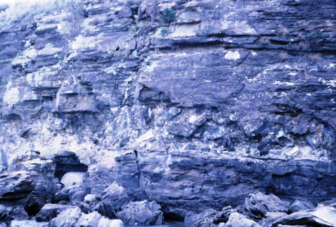
The Shoalhaven district, by which we mean the coastline from Bateman’s Bay to Kiama and inland for up to 40 miles, is of great interest to geologists. There is a considerable variety of rock types and structures because the edge of the Sydney Basin runs across the area, allowing access to the older rocks beneath. Thus, in an area of 2,000 square miles there are sedimentary rocks of many varieties in age from Cambrian to Tertiary, igneous rocks ranging from coarse intrusives to fine grained volcanics and a wide variety of metamorphic rocks. There are examples of folds, faults, unconformities and similar features.
This book is designed to help your understanding of the Science of Geology by providing detailed descriptions of the rock types and structures found in the Shoalhaven district. It is not intended to be an exhaustive treatment of all aspects of the geology – this is available in the literature quoted at the end of this book. It is assumed that the reader has available to him the appropriate geological maps of the area.
Prior to the commencement of the Permian period, some 280 million years ago, the eastern part of Australia was involved in a number of mountain building episodes or orogenies. These involved the deposition of sediments, their subsequent uplift, folding and erosion. As part of the process, extrusion and intrusion of igneous rocks occurred with their associated metamorphic and mineralising effects. All of these rocks constitute what is known as the basement and by the beginning of the Permian period this had largely been levelled by the processes of erosion in the present coastal region.
 However, high mountains still existed in the west and south west and from these glaciers may have moved towards the sea which began to cover the low-lying land. Subsidence led to the formation of the Sydney Basin, the extent of which is shown on the map. At first marine sedimentation prevailed, although small pockets of fresh water evidently existed temporarily, as the Clyde
 Coal Measures formed in restricted localities. Subsequently the marine Shoalhaven Group accumulated to a thickness of several thousand feet. Parts of these sediments are equivalent to the marine Dalwood and Maitland Groups in the Hunter Valley. Volcanic activity in the Kiama district led to the accumulation of the Gerringong Volcanics, and at the close of this episode marine sedimentation ceased.
 Sediments younger than the Shoalhaven Group are only found north of the Shoalhaven River and it is thought that the area of the Sydney Basin had contracted by this time. These consist of the Permian Illawarra Coal Measures and the overlying Narrabeen Group, Hawkesbury Sandstone and Wianamatta Group, of Triassic age.
 Tertiary volcanic rocks are widespread and are the remains of a more recent volcanic episode. Basaltic lavas are found in numerous places and basic and ultrabasic intrusions are common.
The landscape as we see it today is the result of the erosion of all these rocks. Uplift of as much as 3,000 feet has occurred since the Triassic period and this has created the present drainage system. The Sydney Basin sediments dip towards the north and the presence in the sequence of two resistant formations (the Nowra and Hawkesbury Sandstones) has created two gently inclined areas up to 3,000 feet above sea level intersected by deep valleys and gorges.
The last million years has seen the formation of vast ice caps, leading to a world-wide lowering of sea level. Their subsequent melting within the last 20,000 years caused the sea level to rise again, drowning many river valleys and forming the present coastline.
Fossils
For over a century the rocks of the Shoalhaven district have yielded excellent fossils to many collectors. The supply of good specimens is running out in all the better known collecting areas. Conservation of fossil and mineral specimens is in some ways more vital than that of wildlife, since there is no natural regeneration. You should only take such specimens as will be put to good use in representative collections, such as school collections, permanent public displays and similar places. Museum and University authorities are always pleased to identify or receive good specimens.
The sketches illustrate some of the more common forms you are likely to encounter. Reference to the literature should help in the identification of other forms.
https://johnsbluemountainsblog.blogspot.com/2013/12/links-to-all-blog-entries-and-relevant.html All Blue Mountains blogs and videos
All New England and other Geology blogs and videos
Limestone Caves of NSW
Song Studies. Bible studies based on hymns and songs
Shoalhaven District Geology.


Comments
Post a Comment