FIELD GEOLOGY OF THE SHOALHAVEN DISTRICT (PART 17)
Chapter 9 continued
Bungonia, South Marulan and Tallong
These are just a few of the places of interest across the river, which are worth a visit as part of excursions to the Goulburn district.
These are just a few of the places of interest across the river, which are worth a visit as part of excursions to the Goulburn district.
Bungonia Caves
An extensive area of Silurian limestone crops out from South Marulan over a distance of 7 miles in a south westerly direction. The caves are reached by travelling east from Bungonia village. Part of the area is in a reserve and was formerly maintained for tourists until visitor numbers dropped as people preferred to visit the more spectacular caves elsewhere in NSW.
The Lookdown is the best known feature here. There is a very
sharp drop of 1,200 feet to Bungonia Creek. This may be descended with care to the right of the lookout. The limestone here contains typical Silurian fossils, particularly the coral Favosites. Grykes or solution grooves are also prominent.
 |
| The Lookdown December 1963 |
 |
| The Slot Bungonia Gorge from Adam's Lookout December 1963 |
There are numerous caves, many of which open up from the bottom of depressions or sink holes.
These are identified by a number at their entrance and should not be entered except by experienced speleologists with proper equipment. There have been a number of fatalities here in recent years, caused by inexperience or fatigue.
Hogan’s Hole (B5) contains several long drops.
 |
| The author in the Grill Cave December 1968 |
The Efflux (B67). This is a stream cave where water escapes from the plateau above. Patient excavation over a long period has still not allowed access to the extensive passages believed to exist upstream.
South Marulan
From Marulan, a road leads out, over granodiorite of the Marulan batholith, to the edge of the Shoalhaven gorge. In the quarries of the Southern Portland Cement Company, the limestone has been
converted to a coarse granular marble. At the northern end of the quarry, just below the offices, several basic
dykes intrude the marble as well as a poorly defined ore body containing pyrite, arsenopyrite and chalcopyrite. Slate is exposed on the eastern side of the quarry. This appears to be separated from the limestone by a major fault.
 |
| Marulan quarry from Long Point Tallong June 1971 |
 |
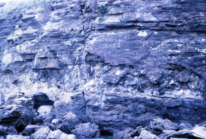
| Dykes cutting the marble at South Marulan quarry December 1966 |
Tallong
At Long Point Lookout, there is a superb view of the Shoalhaven gorge. The track descending to the lookout exposes black slate in which occasional Upper Ordovician graptolites may be found.
The track leading south from the lookout reveals several small outliers of Permian conglomerate resting on the slate.
 |
| The Big Bend Shoalhaven River Long Point Tallong June 1960 |
From Tallong railway station, Caoura road runs for 15 miles through basalt country, leading eventually to a point above the junction of the Shoalhaven and Kangaroo Rivers. See Excursion 4d, Diversion 2. Opalised wood and agate have been found beneath the basalt and the trip is worthwhile for the extensive views obtained en route.
Questions
1. Discuss the mineralisation of the basement rocks north of Sassafras.
2. Outline in detail an unconformity observed in this area.
3. Account for the present distribution of basalt at Sassafras, Quiera, Tolwong, and Caoura.
4. Present evidence for river capture in the Tolwong district.
5. Give reasons for the sparse population of the Ettrema-Sassafras-Tolwong areas.
6. Suggest reasons for the persistence of the Nowra Sandstone over such a wide area.
7. Discuss the probability of further mineral discoveries in the Ettrema, Touga, and Tolwong districts.
https://johnsbluemountainsblog.blogspot.com/2013/12/links-to-all-blog-entries-and-relevant.html All Blue Mountains blogs and videos
All New England and other Geology blogs and videos
Limestone Caves of NSW
Song Studies. Bible studies based on hymns and songs
Shoalhaven District Geology.


Comments
Post a Comment